Svalbard 2023 - Day 4 - Trygghamna Bay (N: 78°15.205' E: 13°46.481' )
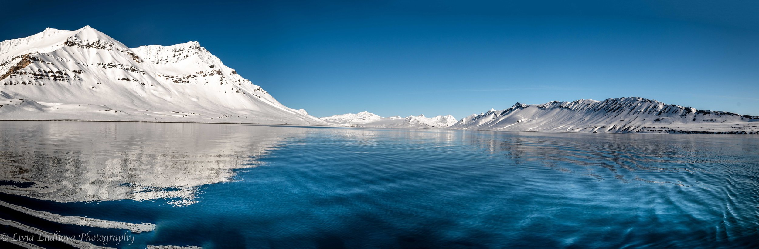
We woke up to a sunny day, surrounded by the blue and white spectacle of the Trygghamna bay. Trygghamna translates into “safe harbour”, as it is well sheltered and protected from most winds. This made the bay ideal also for various settlers - there are remains of 17th century English whaling station, 18th century hunting station of the Pomor of Russian hunters, as well as Norvegian trappers from 19th century. We made our first zodiac landing, exploring shores that hold remains of a historic hunters’ hut as well as a recent governor’s cottage set on a very panoramic position. Several Svalbard reindeers, an endemic specie, are sprinkled around to complement this surreal scenery. We hiked close to the 428-meter high Alkhornet cliff , where some 10,000 pairs of different seabirds breed. The tundra at the bottom of the cliff receives nutrients from the sea birds and provides rich meadows attracting wildlife: grazing grounds for reindeer, nesting places for geese and denning sites for arctic foxes.
Svalbard 2023 - Day 4 - Alkhornet (N: 78°13.616' E: 13°50.241' )

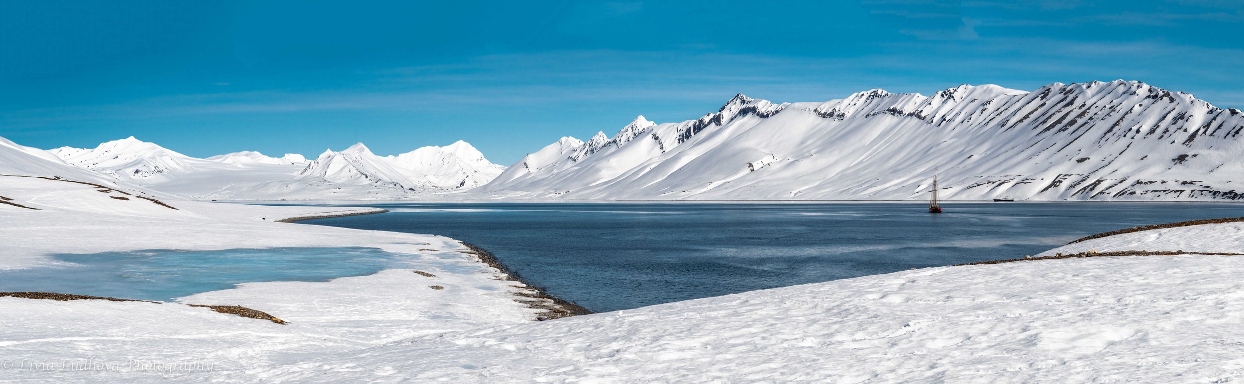
Beautiful morning in the Trygghamna bay....

.... we enjoy it from the board of the Dutch sailing ship Norderlicht.

To go practically anywhere in Svalbard, it is obligatory to be armed with guns against the polar bears - of course to be used as the last options.

After the zodiac landing, waiting until everyone will be on shore.

White snow, grey pebbles, and the blue arctic waters.

Elegance of our Norderlicht.
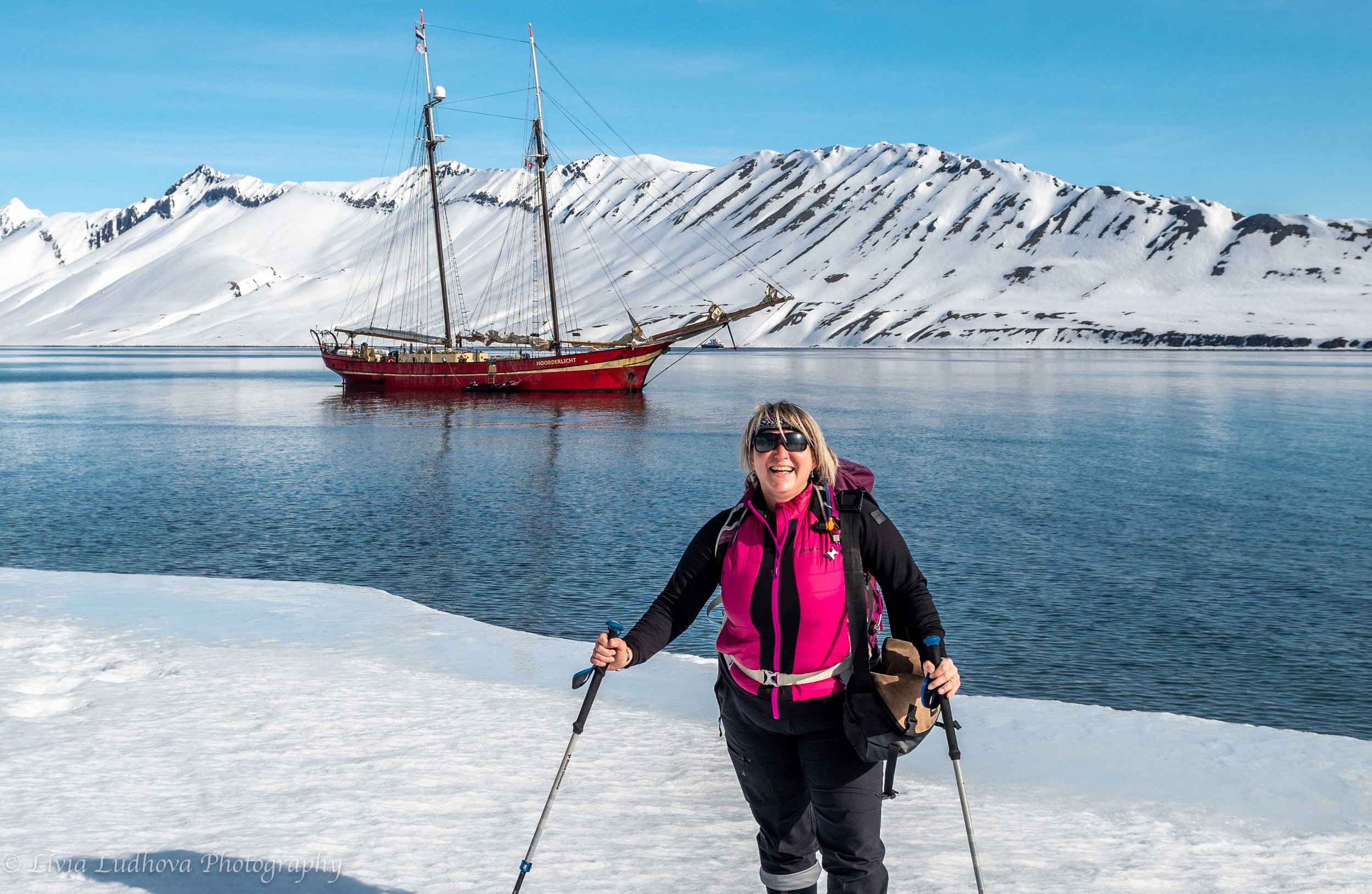
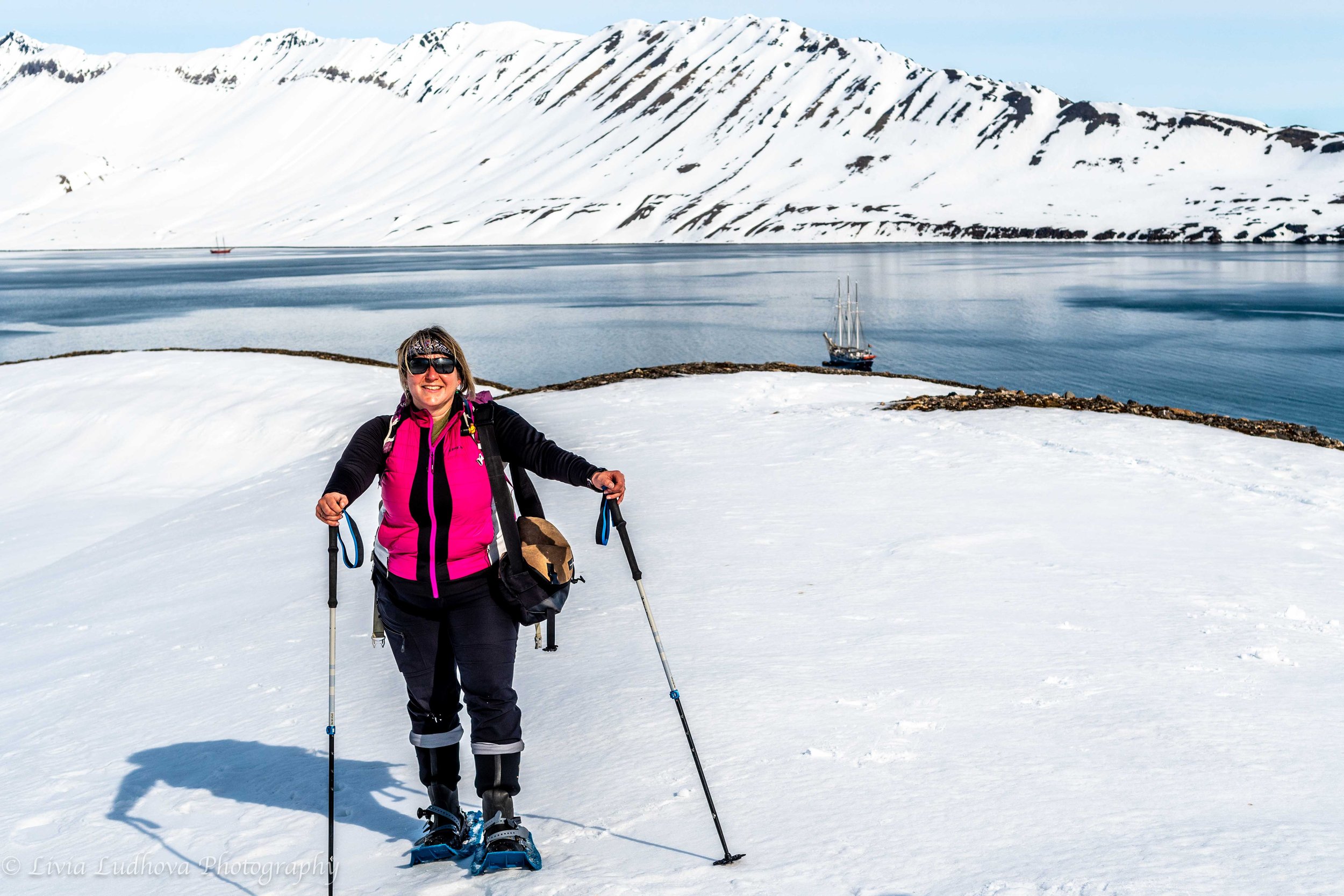
Of course I want a photo with our ship in the background!
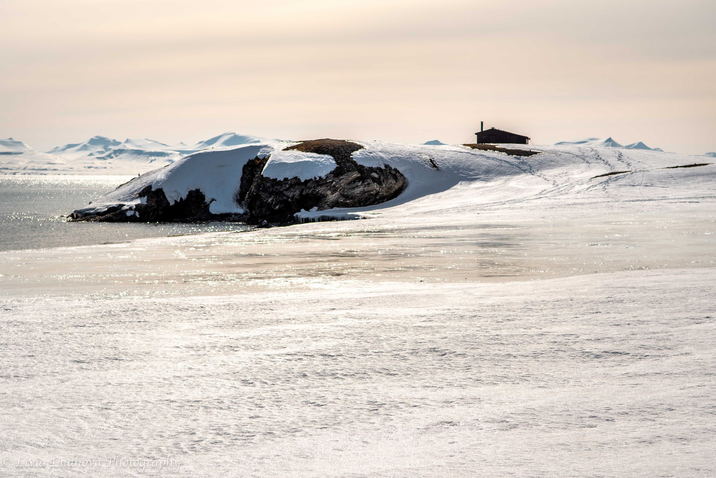
Governors hut on the hill overlooks the bay.

Our group walking towards the Alkhornet cliff.

Remains of a reindeer in a super-weird form, in which just the hardest bones of skull and spine remained.

Detail on the head with remains of the fur.

Light show above the bay.

Governors' hut above different shades of blue and white.

Another sailing ship pays a visit.

It is Rembrandt van Rijn ran by Oceanwide Expeditions.

After some walking, Alkhornet shows up....

Fertile meadows below the cliff attract reindeers.

An example of historical relics below Alkhornet.

Svalnbard reindeer, endemic local sub-species that is smaller than the Scandinavian reindeer.
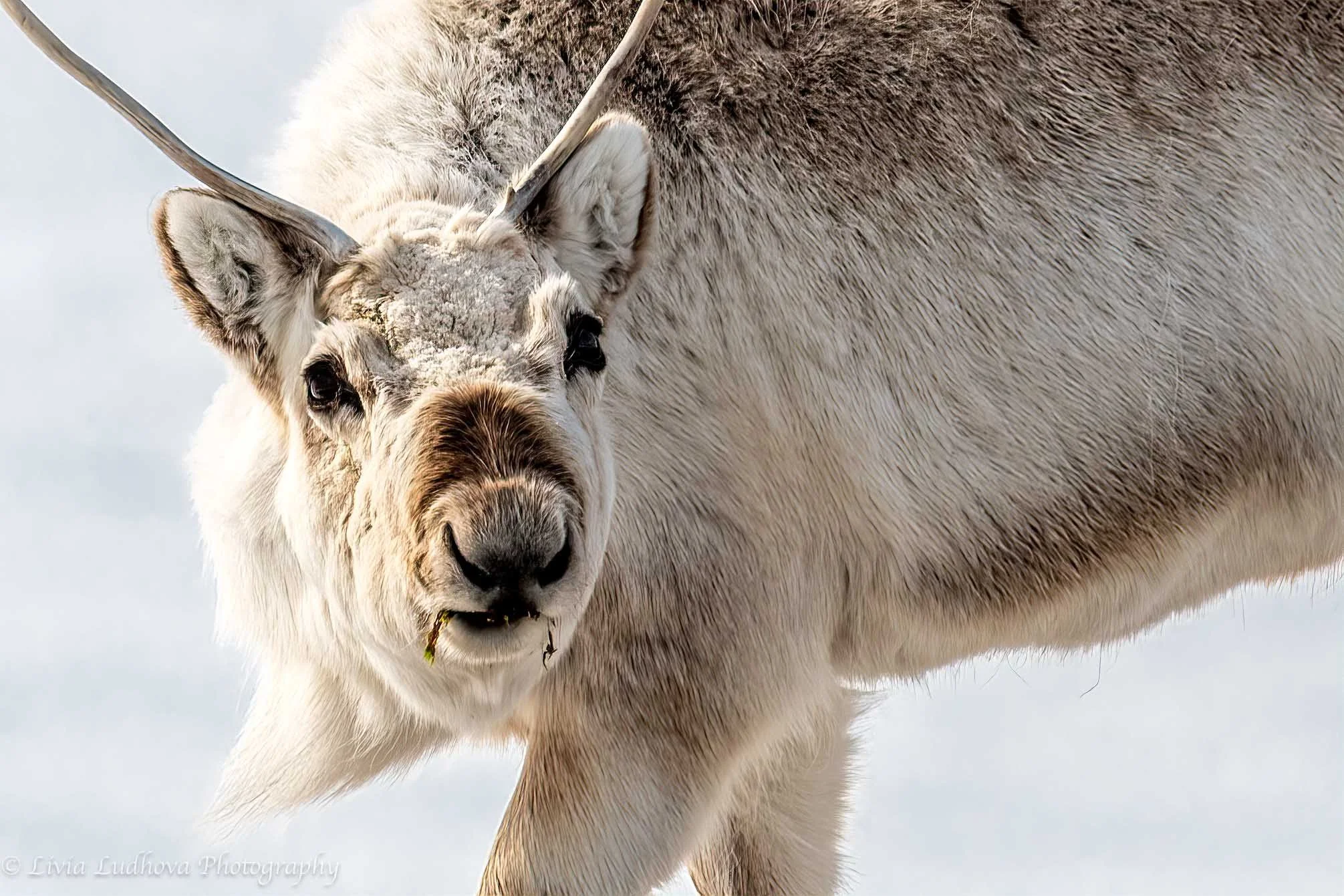
Magical nose of the Svalbard reindeer. Thanks to its complicated inner structure with a large effective surface, reindeer can heat up the cold air up to body temperature and retain the precious water as it breath it out. The efficiency grows with decreasing tempretaure, so it can almost insteantly increase the air temperature by even 70 degrees!

Short legs and thick fur made the Svalbard reindeer look less elegant, but it is a jewel of the evolution and adaptation to this extreme habitat.

This arctic scene in pastel shades of white struck me right into heart.

Arriving under the cliffs of Alkhornet.

The air around the cliff is full of flying birds, that circle around their nests.

There are various species, as kittiwake, Brünnich's guillemot, fulmars....

Alkhornet consists of metamorphosed carbonate rocks, more than one billion years old bedrock. In contrast, on the other side of Trygghamna, Permian and Triassic rocks are dating back only about 200 to 300 million years.

A group of guillemots - black head and top of the body, and with a white belly.

Another carcass of a dead old reindeer.

Old reindeers often dye from starvation, as their teeth are destroyed from the soil and sand that they chew on together with the small vegetation.
Yet another pose in this special place.

Heading down back to the zodiacs.

Last glimps of the Alkhornet.

Beatiful color contrast of our lady.

Svalbard 2023 - Day 4 - Prince Charles Foreland
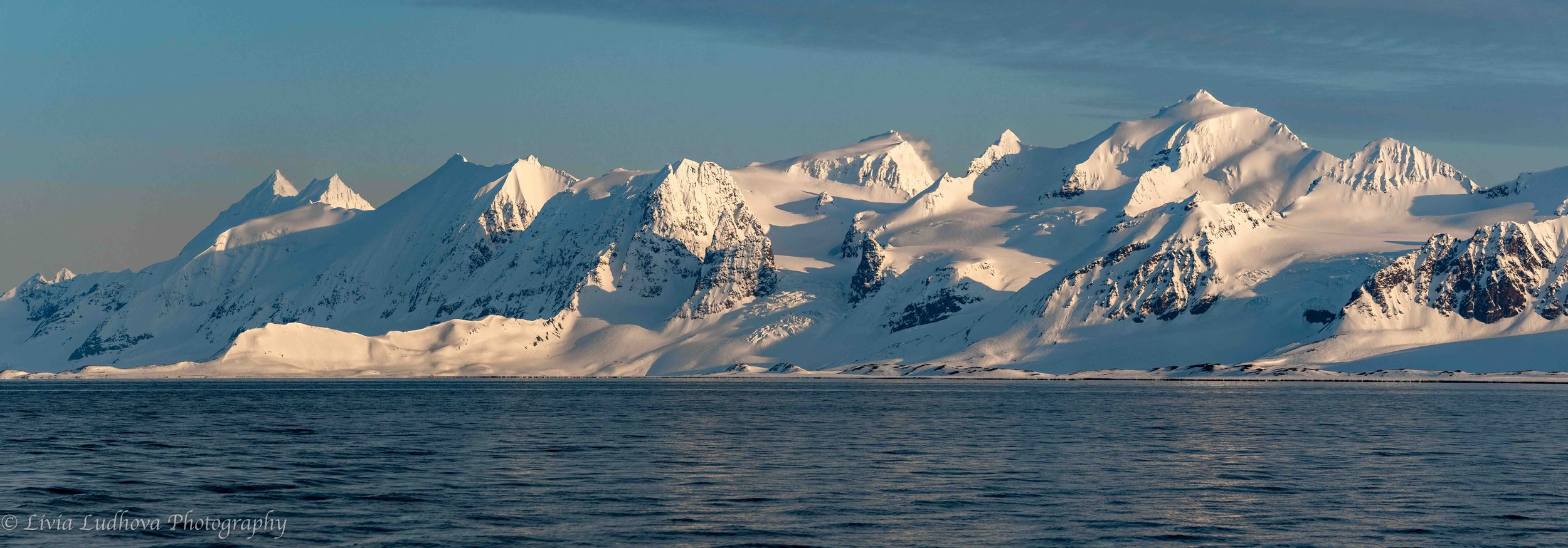
Prins Karls Forland or Forlandet, occasionally anglicized as Prince Charles Foreland, is an island off the west coast of Spitsbergen. The entire island and the surrounding sea area constitutes Forlandet National Park (Forlandet nasjonalpark). It’s the easternmost island of the Svalbard archipelago and the most exposed to the Atlantic winds and pounding waves – desolate, exposed, rough, and beautiful

Elongated island has mountains on both ends and a flat part in the middle in a curious contrast.
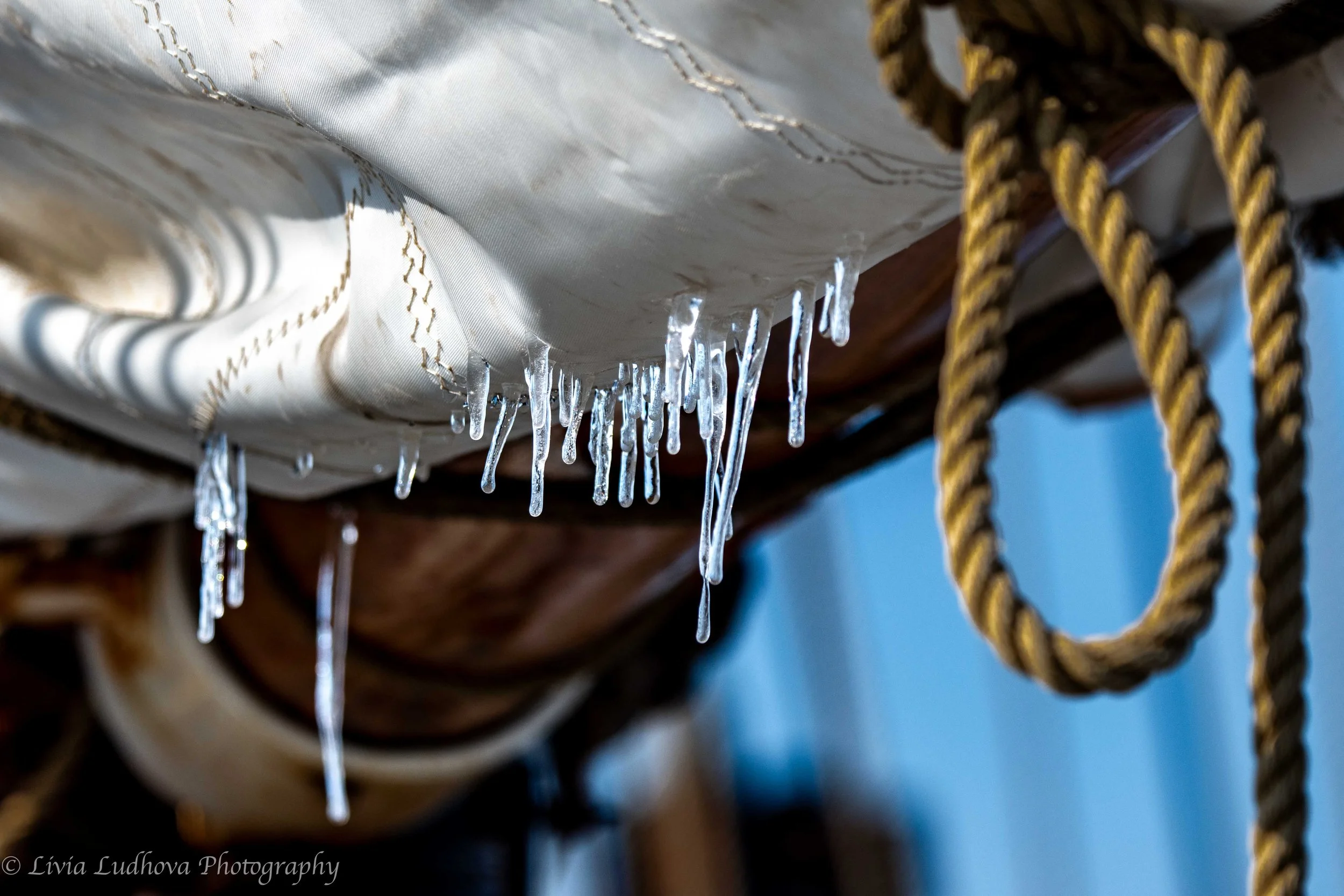
Icicles on a sail.

Lanes in forefront.

The helm of Norderlicht is under skies.

Other mountainous side of Prince Edward Island.

Actually we were allowed to take over at the helm....

More mountain views in this spectacular weather.

Sail, lanes, sea and snow.

Softer colours, but no, the Sun was not setting down at all.
Svalbard 2023 - Day 4 - Poolepynten
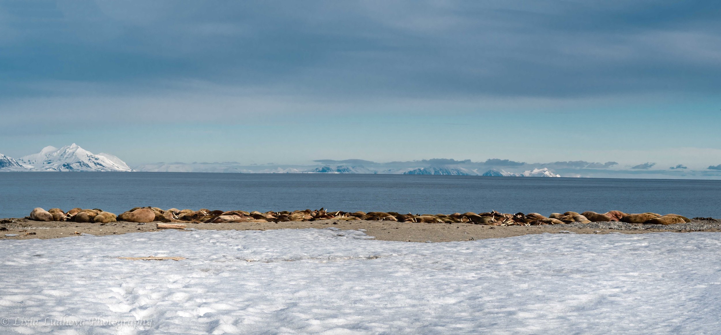
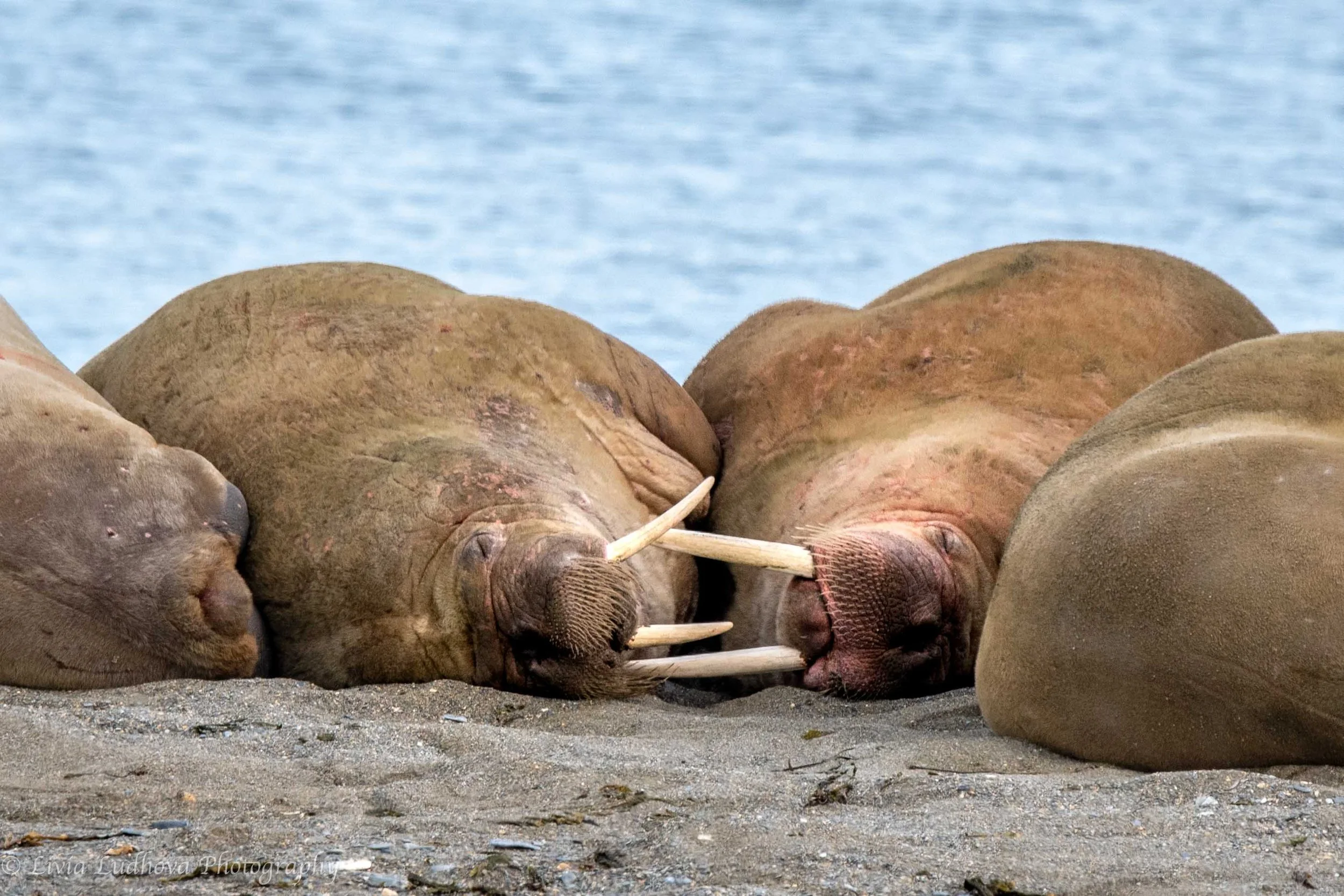
Poolepynten is named after an early 17th century explorer and whaler Jonas Poole. It is a headland at the eastern coast of the Prince Charles Foreland and a part of the respective national park. A large colony of walruses can be found on a local sandy beach. These large and heavy animals (up to 2 tons) are great swimmers, but on land rather lazy…. only occasionally turning, showing flippers and lifting heads with giant tusks. They were hunted for blubber and got to near extinction, with populations now slowly recovering. Still, the Atlantic walrus is quite rare and groups are relatively small compared to Pacific ones. The areas is covered in logs that have drifted all the way across the Arctic Ocean from Siberia.


Svalbard 2023 - Day 4 - 14th July Buchta ( 79°07.148' E: 11°52.227' )
Cruising towards the 14th July buchta (bay in Russian) is breathtaking. We will spend the night there, with a sight of the same-name glacier, named after the French Bastille Day (14.7. 1789) by Prince Albert I of Monaco. The 14th July Glacier is 16 km long and it reaches more than 30 m above sea level.


